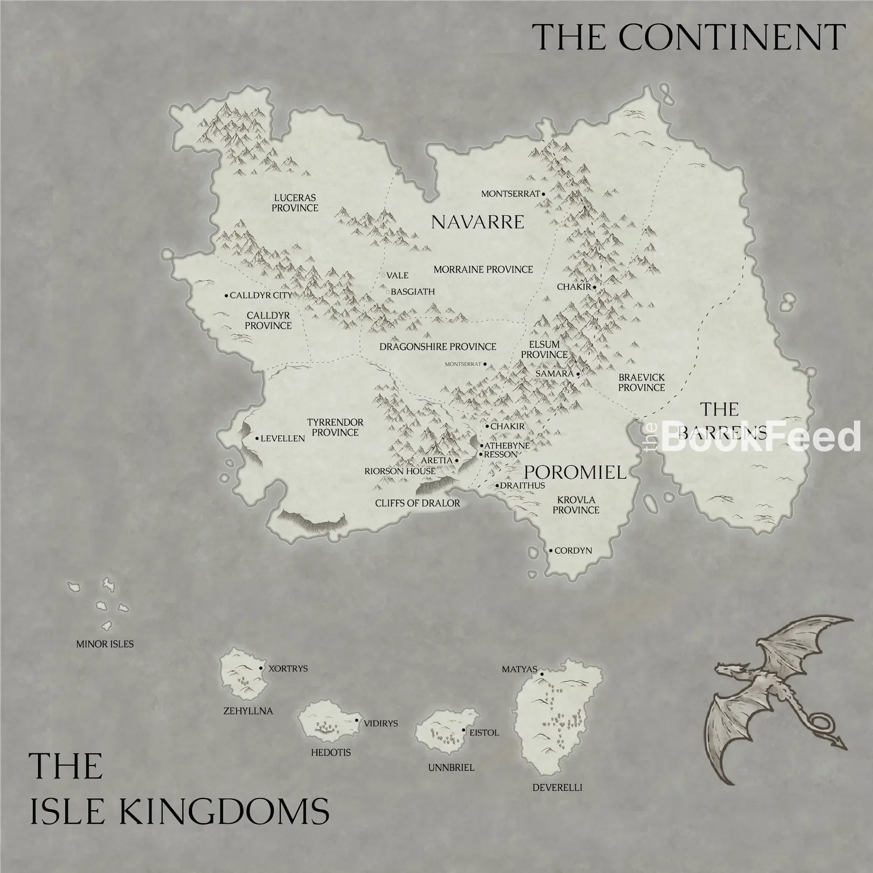
Onyx Storm Map
This fan-created Onyx Storm map compiles every detail from the book to visualize the four Isle Kingdoms and their coastal capitals. Using clues from the text—geography, distances, and location descriptions, we pieced together a visual guide to the Isle Kingdoms featured in Onyx Storm.
Contents
Comprehensive Onyx Storm Map
To piece together a complete map for Onyx Storm we looked through all details mentioned in Onyx Storm.
Fourth Wing takes place on a fictional continent split among The kingdoms of Navarre (primary setting), Poromiel, and the Barrens. The Isle Kingdoms are mentioned in Fourth Wing and Iron Flame but we learn about them in detail in Onyx Storm. Each Isle forms a separate Kingdom.
Onyx Storm Isles – Important Questions (Quick Answers)
Looking for an Onyx Storm map or trying to understand the Isle Kingdoms? Here are quick, spoiler-aware answers about where the islands are, who rules them, and what makes each isle distinct.
What are the Isle Kingdoms in Onyx Storm?
The Isle Kingdoms (often called “the Isles”) are a chain of five large and thirteen smaller islands south of the main continent. Each major isle functions as its own kingdom, with distinct rulers, cultures, and religious practices introduced in Onyx Storm.
Where is Onyx Storm set?
Onyx Storm is set in the same world as Fourth Wing, but it expands the setting beyond the main continent into the southern seas. A major portion of the book’s geography focuses on the Isle Kingdoms—the islands south of the continent—whose locations are described through routes, directions, and travel times rather than an official printed map.
Is there an official Onyx Storm map?
Not for the Isles. Fourth Wing includes a map for the main continent, but Onyx Storm introduces the Isle Kingdoms without publishing an official island map—so readers piece locations together from travel times and descriptions.
Where are the Isles located relative to the continent?
The Isles sit off the southern side of the continent, separated by open sea. In Onyx Storm, routes between isles are described via flight times, directions (like west or northwest), and coastal details—enough to build a working map.
How was this Onyx Storm Isles map created?
This map is built from text evidence: stated travel times by dragon and ship, direction cues (due south, west, northwest), mentions of trading routes, and landscape descriptions (climate, vegetation, coastlines, and capitals).
What are the Minor Isles?
The Minor Isles are smaller islands around the main kingdoms. They’re described as largely uninhabited, dense with jungle, and unusually high in magic concentration—details that matter when charting routes and hazards.
The Isles
| Image | Name | Ruler | Description |
|---|---|---|---|
 | Deverelli | King Courtlyn | Deverelli doesn’t worship gods and is widely known as a trade-first isle with a focus on science. |
 | Unnbriel | Queen Marlis | The isle is devoted to Dunne, goddess of war, and is famed for its trials by combat. |
 | Hedotis | Triumvirate council | Also called the Isle of Wisdom, known for its libraries, pastel attire, and devotion to Hedeon, the god of wisdom. |
 | Zehyllna | Queen of Zehyllna | The island is known for white beaches, waterfalls, and its worship of Zihnal, the god of luck. |
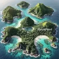 | Minor Isles | Uninhabited, dense with jungle and high in magic concentration. One isle is marked by black-sand beaches and a hollow-tipped peak. |
Deverelli
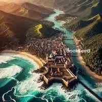
Location: Deverelli is the southernmost isle located a two-day south journey by ship or twelve hours by dragon, south of Cordyn. It is defined by hot climate and endless lines of white beaches along turquoise waters. Moving towards the inland of the island soft green hills start to rise with stone structures spread across them. These structures belong to the capital city, Matyas, hidden by the trees.
East of Deverelli is a small barrier island that houses elegant manors with private docks and ships reflecting their owners’ status and wealth.
Culture: Residents of Deverelli do not worship gods. They are more focused on science and Alchemy. This makes them a neutral island and optimal for trade. Though neutral and the most of the population being unarmed, Deverelli has an army, referred to as guards. They carry spears tipped with serrated silver blades or axes. The residents are educated and wear lightweight tunics , often white or gold, or gowns of various pastel colors.
The term “Fire-bringer” is used as an insult to describe dragon riders.
Unnbriel
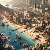
Location: Unnbriel, also known as the Isle of Dunne, is located a nine hour flight west of Deverelli. The coastline is defined by white-capped teal waters, crashing onto cream-colored beaches. It hosts a port city that is protected by walls and cross-bolts. Moving inland, the beaches become rocky, eventually turning to rolling hills covered in thick vegetation. The island’s climate is similar to that of Deverelli, hot and humid. The capital city, Eistol, is heavily fortified and located inland on the tallest hill for miles.
Culture: Residents of Unnbrish worship Dunne, the goddess of war. The Unnbrish practice trial by combat where victorious combatants earn entrance to their court at the rank of their defeated opponent.
Cavalry soldiers patrol the streets wearing pale green, pale blue or silver leather armor with metal chest plates bearing the symbol of goddess Dunne – two crossed swords gripped in the center with a claw. Before meeting the queen, visitors must undergo a ritual to prove their worth. The process involves choosing a champions to face the Unnbrish in trial by combat.
Hedotis
Location: Hedotis, also known as the Isle of Wisdom or the Isle of Hedeon, is located a thirteen hour flight from Unnbriel. It is described as a beautiful island with a slightly colder climate compared to the other isles further east. The capital city is Vidirys.
The vegetation on the island is even paler than on the other isles, with pale, barely green seagrass and bramble bushes.
Culture: Many Hedotis’ residents have purple eyes. This is due to the mineral viladrite, which turns paler eye colors purple. Many residents worship the god Hedeon. The residents wear pastel-colored tunics and gowns, often in one-shoulder fashion. Tunics with intricate metallic embroidery indicate wealth.
Zehyllna
Location: Zehyllna is located further northwest in relation to the other isles, past the regular sea trading routes. Leading up to the isle is an archipelago – a group of smaller isles. Zehyllna is defined by beautiful white sand beaches, green-leafed trees, sparkling rivers, and waterfalls. In contrast to the other isles Zehyllna has magic, though not as much as on the Continent.
Culture: Residents of Zehyllna worship Zihnal, the god of luck. The language spoken on the island is called Zehylish. The capital city of Zehyllna is Xortrys. The city is surrounded by a curved waterfall and the architecture of the city is a jumbled series of additions to previously built structures. One part of the city hosts an amphitheater big enough to host hundreds or thousands of people.
Mapping the Isles in Onyx Storm
Let’s take a closer look at each island and the breadcrumbs of information we used to place them on the map.
Deverelli
“… which mostly cover the southernmost isle of Deverelli…” (Chapter 13)
The distance from Cordyn to Deverelli is described as a twelve-hour flight directly south by dragon:
“Which would make it what? A twelve-hour flight due south?” (Chapter 21)
Additionally, when Violet and her squad leave Deverelli for Umbriel, they fly over its southwestern coastline:
“They can’t just float if they get tired, and nine hours from now will put our total flight time at twelve.” (Chapter 29)
Umbriel
Flying southwest from Deverelli for another twelve hours brings the squad to Umbriel, the next island in their journey. Unfortunately, the book provides limited geographic details beyond its general location.
Hedotis
The journey to Hedotis provides slightly more information. Violet and her team describe a thirteen-hour flight toward Vidirys, Hedotis’ capital city:
“… a thirteen-hour flight…” (Chapter 33)
After their stay in Hedotis, the squad heads northwest along established trading routes:
“…heading northwest along the trading routes.” (Chapter 37)
From there, they make their way to Zehyllna, a flight that takes approximately twelve hours. Based on these details, we placed Hedotis northwest of Umbriel on the map.
After departing Zehyllna, the team travels northwest at dawn (chapter 40), reaching the first of the minor islands after 16 to 18 hours:
“By the middle of the night, I’m ready to give up and order our return when Tairn spots land.” (Chapter 40)
Final Thoughts
The journey through Onyx Storm expands the world of the Empyrean series far beyond Navarre, introducing the complex politics, cultures, and landscapes of the Isle Kingdoms. From the neutral trade hub of Deverelli to the wisdom-obsessed Hedotis, every stop adds new depth to the story — and new challenges for Violet and her quest squad.
This map brings together all the travel routes, capitals, and rulers revealed so far. As Rebecca Yarros reveals more in future installments, we’ll continue updating this guide.
What do you think of the map? Did we get it right, or do you have other theories about the layout of the Isle Kingdoms? Let us know in the comments and share your insights!